Get In Touch
Get in touch with us for any questions or quotes on surveying services and products. We will respond back as soon as we can.
Before an ROV leaves a subsea structure, the survey team needs to know whether the required inspection coverage has been captured. Gaps identified during acquisition can be addressed while the vehicle is still at the asset. Gaps discovered later may require repeat survey work.
Once the survey is complete, integrity engineers need a detailed record they can examine, measure and compare with previous inspections.
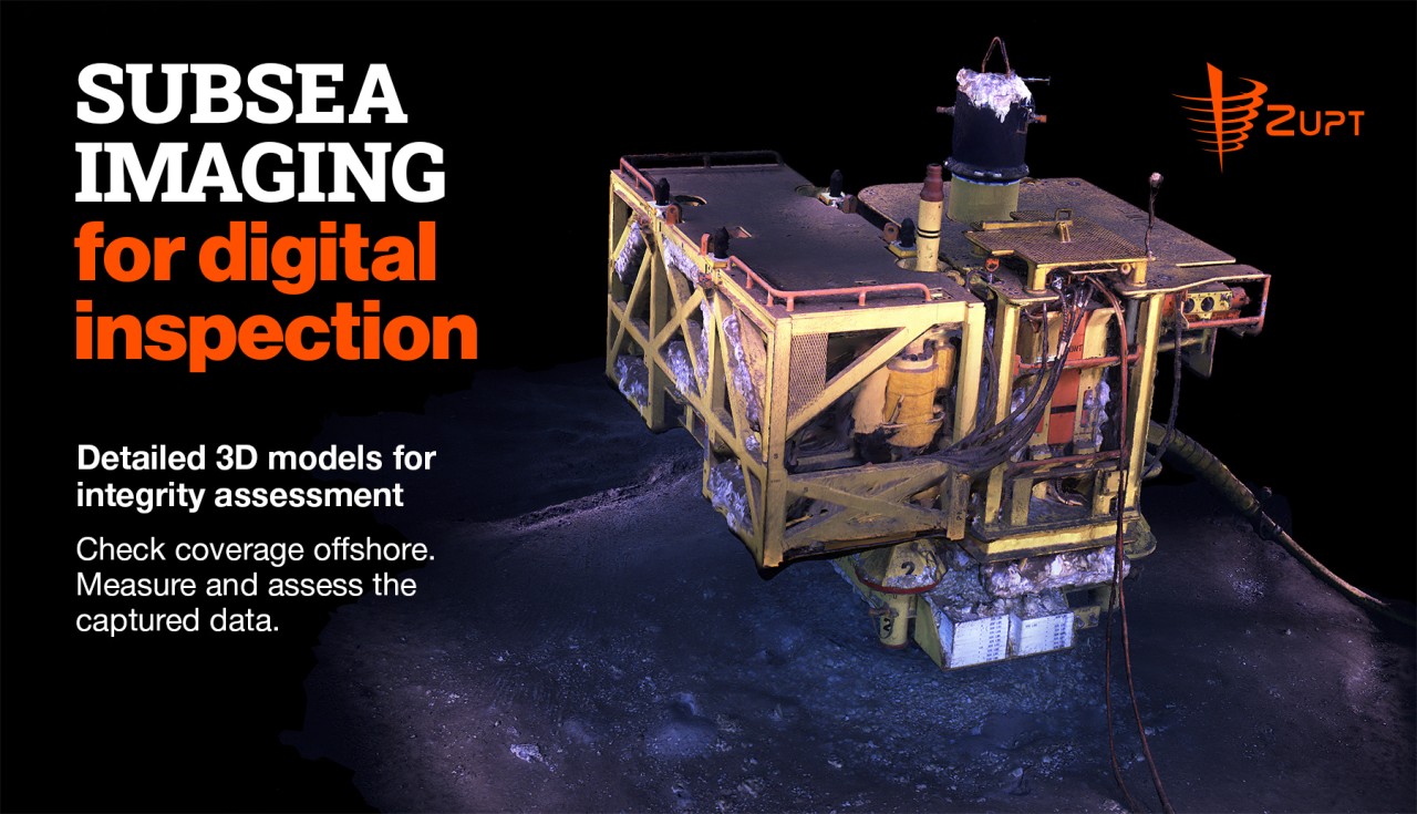
Zupt's 3D Recon V2 supports both stages through real-time dense reconstruction for offshore quality control and detailed models processed offline for engineering assessment. This stereo imaging capability forms part of the broader Fast Digital Inspection workflow.
3D Recon V2 combines two high-resolution machine vision cameras with a high-performance MEMS inertial measurement unit in a housing rated to 4,000 meters.
As the ROV moves around a structure, stereo imaging, inertial navigation and computer vision work together to reconstruct the visible surfaces captured during the survey.
The system generates a dense point cloud in real time. Operators can view their position relative to the structure, track the survey path and assess coverage as data is collected.
This gives the offshore team an opportunity to identify gaps and acquire additional data before moving on, helping reduce rework and make more efficient use of vessel time.
Following acquisition, offline processing produces optimized, high-density point clouds and mesh models for detailed inspection.
Engineers can navigate around the surveyed structure, examine specific areas and take contactless measurements. These deliverables support anomaly inspection, corrosion assessment and anode depletion measurement, as well as comparisons with historical models to assess changes over time.
High-resolution still images and conventional video are available alongside the models, supporting existing inspection review workflows.
Fast Digital Inspection combines detailed planning, integrated inspection technologies and georeferenced deliverables.
Within that approach, 3D Recon provides the imaging and modeling capability. Integration with complementary sensors can bring additional inspection information into the assessment, such as contactless cathodic protection measurements.
The workflow connects pre-mobilization planning, offshore acquisition, quality control, processing and engineering review. Each stage contributes to collecting the required data and delivering it in a usable form.
A case study published by Zupt in July 2025 documents an integrated inspection campaign combining 3D Recon with Ocean Floor Geophysics' iCP system across three deep-water developments.
More than 400 subsea structures were inspected, with over 200 structures fully processed offshore. Deliverables included georeferenced 3D models, cathodic protection heat maps, photography and conventional inspection video.
The campaign reported a 40% reduction in vessel days compared with traditional inspection methods. That result reflects the integrated campaign, including planning, technology integration and offshore workflows.
The case study provides a documented example of the broader Fast Digital Inspection approach. Its results are specific to that campaign and are not presented as a standalone performance claim for 3D Recon V2.
For asset owners, the approach provides a detailed digital record that supports both immediate inspection review and subsequent assessment of asset condition.
Read the Fast Digital Inspection case study: